When you buy a roadbook on our website, you get a gpx track. This is a practical addition to the roadbook based on the dot-arrow or ball arrow principle. But how do you use a gpx-track?
1. Download the gpx track
You will receive the gpx file via e-mail immediately after your order.
2. Choose the right navigation system or app
You need a program/application or device that can read a gpx file.
PC and laptop
I mainly use Google My Maps (take note: that’s not the same as Google Maps) or GPXsee, which is very easy to use.
But you can also use the Gaia-GPS website (see below).
Garmin
Some Garmin navigation devices can handle a gpx track just fine. The problem is that the maps on your Garmin are probably not detailed enough. A lot of small forest roads are missing. As a result, using your Garmin for the gpx track will not always be very useful when you’re offroading.
Smartphone or tablet
It is better to download a good map app on your smartphone or tablet. Such as Gaia-GPS. This app is available for iOS (Apple) and Android. And you can also sync everything with their website. You can find all the info at https://www.gaiagps.com/
The paid version costs about $20 a year. Biggest advantage is that with that version you can download your maps in advance. This means you don’t need a data connection during your trip and you always have all the info to hand. Even if you suddenly run out of coverage or end up in an area with very poor reception.
A good alternative to Gaia-GPS is Outdooractive, also for Android and iOS. And slightly cheaper.
Free and simple is GPXviewer. But you can’t download maps in advance with that.
What about Wikiloc? Preferably not!
We do not recommend Wikiloc. If you do use it, be extra careful not to set the route to public. Because our tracks are copyrighted and you are not allowed to share them.
3. Put the gpx track on your app
There are several ways to put a gpx track on an app. It depends from app to app.
- Via the app website
Log in there and choose ‘Upload’.
Note: make sure you set the track to private and not public. Especially if you use Wikiloc, you need to pay hard attention to this. Our routes are copyrighted and sharing them publicly is punishable.
After syncing, the track will be visible in the app on your smartphone or tablet. - Email the gpx track to your email address and then open it on your smartphone or tablet with the app of your choice
- Open the gpx track after downloading it immediately, ‘forward’ or ‘share’ (iOS from Apple) to the app of your choice.
On Apple, there is also an app called ‘Files’ from which you can ‘share’ (= open) downloaded files with your navigation app.
4. Tip: download your maps in advance
To avoid getting caught without a map while you’re offroading because you have no connection or your data limit has been exceeded, it’s best to download the map on your smartphone or tablet in advance.
You can do this in both Gaia-GPS and ViewRanger.
Gaia-GPS provides a good explanation of how to do this via: https://help.gaiagps.com/hc/en-us/articles/115003525127-Download-Maps-for-Offline-Use
In Gaia-GPS, we recommend Gaia Streets as a base map. It has everything you need and you can zoom in as much as you like. That is why I always download the Gaia Streets map of the country or region I am going to go offroading in, at maximum detail (by setting the slider at the top to 12). All of France is about 1GB. All of Belgium and part of the Netherlands is less than 300MB. That way, you’re always driving around with peace of mind, knowing you’ve got a map to fall back on at all times.
5. While you’re driving
A gpx track is not read out loud as you are probably used to from your usual navigation system.
You simply drive to the starting point and then follow the track from there on the app’s map.
In Gaia-GPS, you can zoom in as much as you like. By clicking on the ‘compass directions icon’ you can switch between the general map view, the route with the map always facing north, or the route with the map always facing the direction you are driving.
Tip: if you don’t use the dot-arrow roadbooks, but mainly the gpx tracks, you can also leave the digital map reading to your co-driver. That way, your passengers have something to do too. 😉
6. Use the waypoints
There are often waypoints along the route. If you click on a waypoint, you get more details about it. On some devices or in some applications, you have to click twice to see this extra information.
A waypoint can be a shortcut, a warning, tourist information, … In many cases, we refer you to a number in the info guide, where you can find additional information. The info guide number is found in () after the name of the waypoint.
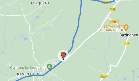
Closed waypoint on the gpx-track
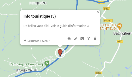
Extra information visible once you’ve clicked open the waypoint
Don’t forget to print your information guide and take it with you. Or, of course, you can put it on your tablet as well.